GPS Software for Google Earth
GPS Software for Google Earth
by Greg Heppenstall
by Greg Heppenstall


Yes, you can pre-load and use Google Earth Offline!
Tallon 1.9
is an integrated, real-time tracking, logging and cache-loader application for Google Earth and Google Earth Pro.
Functions
- Display and Record your real-time Position, Track and Vectors on Google Earth.
- Display saved Tracks and and Waypoints.
- Display distance and true bearing to Waypoints.
- Display Track altitude in 3D.
- Download and Display Tracks and Waypoints recorded on many Garmin GPS receivers.
- Capture and Record any desired image array for the Google Earth Cache.
- Display current cache size.
- Moving Map, North Up/Course Up, adjustable viewpoint Range/Heading/Tilt.
- Listens to your GPS (or GLONASS, etc) NMEA-0183 Source through a physical COM port, a Serial-USB adapter or a Virtual Serial Interface.
- Use any available Serial Port, COM 1 - COM 256
- Use standard NMEA bit-rate (4800) or select any basic rate (300 - 115200).
- Communicates your position via TCP/IP with another instance of Tallon on your computer network, to serve as a remote/portable display. (Wi-Fi)
- Compatible with NMEA Server and NMEA Client
- Use any available TCP Port.
- Display Local IP Address.
- Set/Display IP Address of connected Server/Client
- Track/Log display with/without details, on ground, at 3D altitude, speed as altitude (adjustable), colour-split at track breaks.
- Automatic log files are created daily, separated at midnight local time.
- Waypoint Navigation with vector.
- Displays a 10-minute look-ahead vector.
- New Google Earth placemarks can be entered and used as Waypoints.
- Download tracks and Waypoints from USB-type Garmin receivers including eTrex Legend/Vista HCx, GPSmap 60CSx, GPSmap 76CSx, Nuvi, many others.
- Displayed trackpoint details include Point number/Date/Time/Lat/Lon/Speed/Altitude.
- Reads and writes gpx, plt, wpt and txt Track and Waypoint file formats.
- Nautical/Metric/English units of measurement.
- The cache loader provides an easy-to-use, powerful, precise and efficient means of defining and capturing the images you want.
- Cache loader accepts a track, a free-hand sketch or a list of waypoints as a basic description of your image space.
- Cache loader controls include step size, auto-range, Path multiplier, adjustable dwell-time.
- Includes a comprehensive Help guide.
- Windows XP, Vista, 7, 8, 8.1, 10 (32-bit, 64 bit)
- Google Earth or Google Earth Pro
- GPS Receiver with NMEA-0183 output
- Serial COM Port, USB-Serial Adapter, or Virtual COM Port
- DOWNLOAD
The Tallon Cache Loader is powerful and precise, efficient and easy to use.
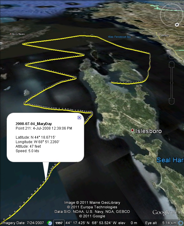
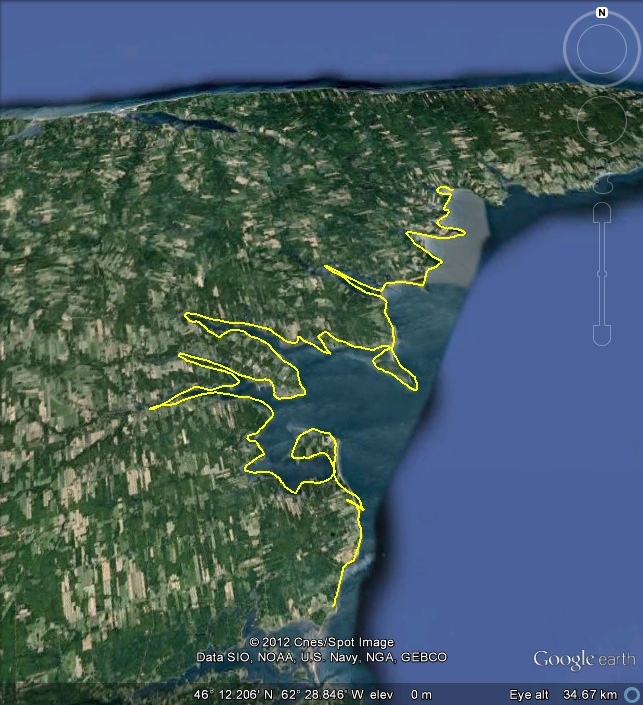
A target zone can be defined by any of several different methods - a freehand sketch, a pre-recorded GPS track,
a PC-Navigo track, a Route, a list of Waypoints, or a scattered collection of Placemarks. In combination
with the Multiplierand Aperture settings, there are many ways to use this flexibility.
In this example, I wanted the cache to contain detailed and continuous images of an irregular shoreline, so...
When you're happy with the coverage, click Start.
Tallon will zoom in to each green box sequentially, and capture every image at full-screen resolution.
When the cache load is complete, you can go offline, select the Tallon real-time tracking function and... go there.
A target zone can be defined by any of several different methods - a freehand sketch, a pre-recorded GPS track,
a PC-Navigo track, a Route, a list of Waypoints, or a scattered collection of Placemarks. In combination
with the Multiplierand Aperture settings, there are many ways to use this flexibility.
In this example, I wanted the cache to contain detailed and continuous images of an irregular shoreline, so...
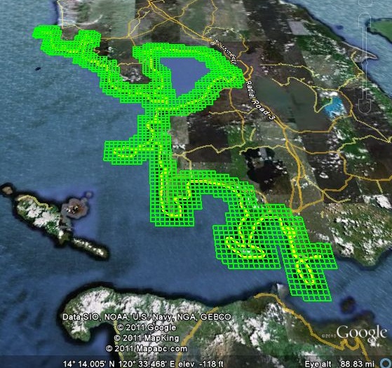
- I sketched a path on Google Earth using its Add Path tool - rough, freehand - took only a few seconds:
- On Tallon, I set the Aperture to 0.5 Minutes, Multiplier to 3; and then I clicked once on Google Earth, and
once again on Tallon. In less than a second, the new scan plan appeared.
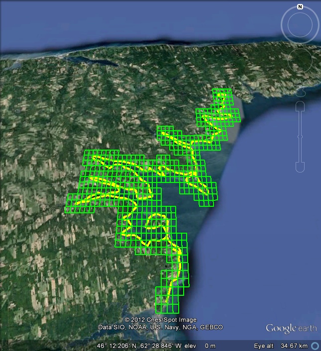
Each green box defines a single image (0.5 Minutes Lat by 0.5 Minutes Lon) to be captured in the cache.
- If the plan had left out any important bits, I might have cranked the multiplier to 5 (or 7, or 9):
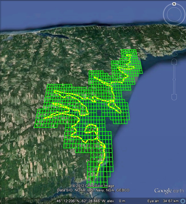
- Or, I might have re-drawn the sketch, added a few more loops and squiggles - to give the math something to do.
When you're happy with the coverage, click Start.
Tallon will zoom in to each green box sequentially, and capture every image at full-screen resolution.
When the cache load is complete, you can go offline, select the Tallon real-time tracking function and... go there.