
GPS Software for Google Earth
GPS Software for Google Earth
by Greg Heppenstall
by Greg Heppenstall


Yes, you can pre-load and use Google Earth Offline!
Harvester 1.7
is an image cache-loader for Offline viewing and tracking on Google Earth and Google Earth Pro.
Functions
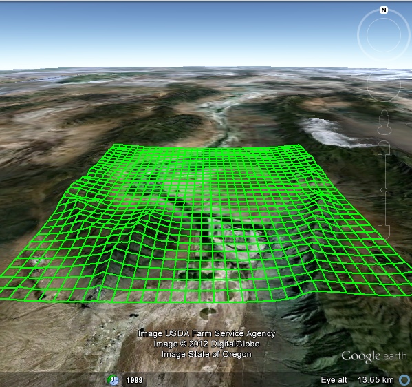
- Scan a user-defined area on the earth's surface, and direct Google Earth to sequentially download and display all the satellite images covering the swept area.
- Display the satellite image at each step, dwell momentarily, and then advance to the next step in sequence.
- Display current cache size.
- A sweep pattern is a repeating series of steps in Longitude interleaved with a single series of steps in Latitude.
- User controls are provided for convenient and rapid selection of Start point, Sweep area, Step size, Dwell time and user viewpoint (Range/Heading/Tilt).
- An Auto Range setting is provided for optimum image capture.
- The Sweep area plan and viewpoint window are shown continuously on Google Earth.
- Adjustments can be made and then engaged to proceed automatically, for as long as required to complete the plan.
- Scan progress is displayed graphically and on a count-down timer, and may be stopped or paused at any time.
- Includes a comprehensive Help guide.
- Windows XP, Vista, 7, 8, 8.1, 10 (32-bit, 64 bit)
- Google Earth or Gooogle Earth Pro
- DOWNLOAD