GPS Software for Google Earth
GPS Software for Google Earth
by Greg Heppenstall
by Greg Heppenstall


Yes, you can pre-load and use Google Earth Offline!
Functions
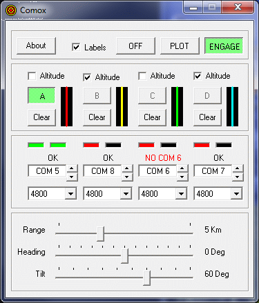
- Display tracks and positions of up to 4 GPS or GLONASS receivers simultaneously on Google Earth.
- Receive position information using NMEA-0183 communications via Serial Port(s).
- Focus any one target position, with a moving-map display, or
- View multiple moving targets on a static display.
- Immediate target selection with moving-map display.
- Convenient viewpoint controls: Range, Heading, Tilt.
- Optional 3D display of target altitude.
- Select NMEA standard bit rate 4800 or other basic rate 300 to 115200 bits/sec.
- Use any four Serial Ports: COM 1 to COM 256.
- All settings are saved and restored between sessions.
- Windows XP, Vista, 7, 8, 10 (32-bit, 64 bit)
- Google Earth or Google Earth Pro
- Up to four Serial COM Ports, USB-Serial Adapters, Bluetooth or Virtual COM Ports.
- GPS Receivers or other NMEA-0183 sources,
connected locally or remotely, to
provide RMC or GGA or GLL Sentences. - DOWNLOAD
